Hydrographic maps are crucial to catching fish. Anglers use these maps to strategize when and where to fish based on the types of fishing structure available. This guide provides a few tips on reading and using hydrographic maps to increase your catch.
 |
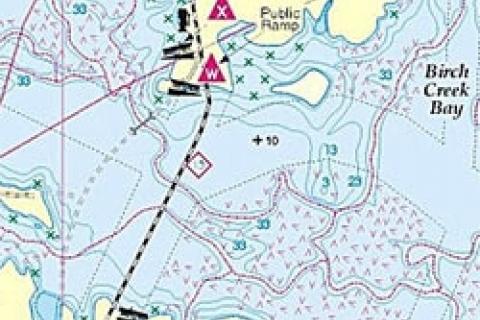
| The level and quality of information on fishing maps varies from basic to very detailed. |
Types of Hydrographic Maps
A hydrographic map illustrates the depth of the water. Depth is often displayed via contour lines, which also show the structures on the bottom. In addition to contour lines, there's often more information provided, like roads for example.
Nautical or marine charts are a type of hydrographic maps used for navigation. They display buoys, hazardous areas, marinas, boat launches, and other important data. Most marine charts also provide data, like elevations, and the shoreline or coastal contours. Note that not all charts will contain contour lines to illustrate water depth or underwater structures.
Recreational fishing maps are also considered hydrographic maps. The level and quality of information on fishing maps varies from basic to very detailed. It's not uncommon to see a disclaimer on a fishing map that the product should not be used for navigation purposes. This is because many are intended to illustrate fishing structure and are not produced with the same quality control and rigor navigational maps. Whenever possible, use marine charts with contour lines instead of fishing maps to ensure safe passage and so you have adequate information at your disposal.
Reading a Multi-Dimensional Lake Map: The Scale
Regardless of what kind of map you're interpreting, some fundamentals don't change. Always read the map's scale. It'll give you an idea of the size of the water body and the structures you'll want to fish. This is particularly important if you're exploring a new area. Neglect the map's scale and you might find yourself taking an extra long boat ride or fishing in a pond instead of a lake. Quality maps provide various measurements for distance, such as nautical miles and feet.
Look at the Map Legend
Familiarize yourself with the legend. A hydrographic map's legend often contains various symbols representing geographic features, roads, nautical points of interest, abbreviations, and sometimes fish species. The legend provides information that's critical to interpreting the map and understanding the area.
For example — if you don't notice that access to a new lake is via a logging road (a dotted line) and there have been heavy rains, the route could be washed out. You'll often refer to the legend when using a map to understand the underwater area and surrounding landscape.
Reading Contour Lines for Structure
Anglers use the information provided in contour lines to get a picture of the structure within a water body. At a minimum, contour lines are marked with numbers to demonstrate the water depth. In some instances the spaces between the lines will be shaded, with the darker areas representing deeper water than the lighter shaded sections.
Points and reefs will be lighter-colored structures in comparison to the darker-colored, deeper water surrounding them. With shaded maps, these light-colored structures will pop out of the surrounding deep water.
Contour lines that are close together illustrate a rapid change of depth, like a drop off; conversely, lines spaced far apart illustrate a gradual change in depth, such as a shoal. Learning to visualize the structures represented by the lines and shades comes with time, but once you pick it up, you'll quickly be spotting great fishing spots.
In addition to contour lines, some maps have icons associated with popular fish-holding spots, like rocky areas, sandbars, shoals, and marshes. These make it easy to find structure and cover.
Looking for Prime Fishing Spots
Once you've spent time reviewing the map and identified promising structures, the next step is looking for additional information to determine which ones are prime spots. For example, creeks or streams entering into a lake can be excellent spots to fish, bringing oxygen, food, and current into the main system. Bridges, culverts, and other human-made structures can sometimes boost the fish-holding properties of an area.
It's also important to overlay the seasonal behavior of your target species with the information on the map. Here are two examples:
- If fishing for post-spawn walleye in a medium sized lake, use a map to identify possible spawning areas (shallow, rocky areas with moving water or rivers). Next, scan the map to locate recovery spots, like shoals or points, near the spawning sites. You'll want to start by fishing these areas.
- If targeting largemouth bass in the summer, you might concentrate on shoals as these are likely to hold weeds, making for great largemouth habitat. Of course, proximity to deep water is a key factor separating average largemouth spots from great ones. Two bays may appear to be quite similar, but when cross-referenced with a hydrographic map things might be different. Perhaps one is off a steep break and the other is at the end of a slow, sloping shoal. In many cases, I'd first try the former spot as I think it'd hold big bucketmouth better than the latter area. Of course, all sorts of factors come into play, with food being a major one, which should always be considered in your fishing strategy.
Recording Your Results
I guess it comes down to personal preference, or how neatly you write, but I like to use pencil instead of permanent pen or marker when
 |
| Not only will a waterproof map case keep them dry, but it'll also prevent them from flapping and flying away when boating down the lake. |
marking a map. That way I can erase my notes if a spot doesn't produce or isn't what I envisioned. That said, if you go to a spot and it doesn't hold fish, don't get rid of your notes right away. Fish patterns on a water body will change as a lake evolves (e.g., weed growth might be rampant in an area one year and then vacant the next), so don't discount a spot if it didn't hold fish the first few times you fish it.
I use highlighters to mark areas I want to stand out, such as marker buoys or spots I need to avoid, like rock shoals. I also jot down important local numbers on a map in case I need to make an inquiry or emergency call with a cell phone on the water. Bait shops, local fisheries offices and police stations, lodges, and launch ramps are just a few numbers worth noting.
When on the water, make it a habit to regularly update your maps with notes. It pays to stick with the same symbols the map uses for consistency. If areas are already marked, add more detail whenever possible.
For example, if the map notes a rocky area, be more specific and specify the types of rock. Does it contain big boulders or small, craggy rocks? You might also note the travel time to get from one spot to another; it's amazing how you can forget how long a boat ride is over the winter.
I highly recommend investing in a waterproof map case. Not only will it keep them dry, but it'll also prevent them from flapping and flying away when boating down the lake. Also consider carrying a waterproof notebook and pen. This way you can make notes during inclement weather and then update your map someplace dry.
These are a few suggestions on using hydrographic maps to make you a more knowledgeable angler. Whatever you use, personalize your maps with on-the-water observations to make them even more detailed and a great fishing tool.
- 13347 views